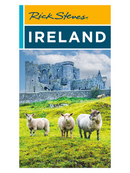
Ireland Guidebook

- Rick's picks for sights, eating, sleeping
- In-depth coverage of our favorite Irish destinations
- Great self-guided walks, drives, and sightseeing tours
- Includes handy full-color foldout map
- Download and print a PDF gift card for holiday gift giving
Buy your Ireland Guidebook:
What's Included
In Rick Steves Ireland you'll find in-depth Rick-tested information on:
-
Dublin and Nearby
- Dun Laoghaire
- Boyne Valley (including Brú na Bóinne and Trim)
- Glendalough and the Wicklow Mountains
-
South Ireland
- Kilkenny and Waterford
- The Rock of Cashel
- Kinsale and Cobh
- Ring of Kerry, sights near Killarney, Kenmare, Skellig Michael
-
Dingle Peninsula and Nearby
- Dingle Town
- Dingle Peninsula driving tour
- Blasket Islands
- Tralee
-
County Clare & the Burren
- The coast, Doolin, and Ennis
- Galway
- Aran Islands
-
Connemara and Westport
- Cong
- Westport
- Connemara driving tour
- East of Connemara: Knock Shrine, Strokestown Park and Irish National Famine Museum
-
Donegal and the Northwest
- County Donegal driving tour
- Between Westport and Derry: Drumcliff Village, Mullaghmore Head, Donegal Town
-
Northern Ireland
- Derry
- Antrim Coast and Portrush
- Belfast
- Bangor
-
Practicalities
- Self-guided walks
- Easy-to-follow maps (including color maps of Ireland, central Dublin, and the Dingle and "Ring of Kerry" Peninsulas)
- Trip planning: When to go, pre-trip checklist, festivals and holidays, recommended books and movies
- Recommended two-week itinerary and advice on planning your time and avoiding lines
- Transportation: Driving, trains, buses, city transit, and ferries
- Irish history, culture, language, and cuisine
- Handy Irish–Yankee vocabulary list
- Detailed advice on managing money, communicating, reserving rooms, handling emergencies, and other helpful hints
Also included: a 14½" x 19½" full-color foldout Planning Map that shows all of Ireland, plus key driving distances/times and a close-up of the Dingle and "Ring of Kerry" peninsulas — as well as more handy close-ups (showing major sights) on the back: Dublin, Belfast, and the Dingle and Ring of Kerry peninsulas. (Note: This is a slightly smaller version of Rick's stand-alone Ireland Planning Map.)
Product Details
| Author(s): | Rick Steves & Pat O'Connor |
| Dimensions: | 8" x 4 ½" x 1" |
| Weight: | 14.5 oz |
| Pages: | 728 |
| Publication date: | November 2024 (22nd edition) |
| Next edition arrives: | July 2026 |
Is This the Right Book for Me?
What's the difference between this Ireland book and Rick's Best of Ireland guidebook?
Rick Steves Ireland, the complete guide, offers more coverage of more destinations in a mostly black-and-white format.
The shorter Rick Steves Best of Ireland guidebook focuses on Ireland's top destinations and sights, is in full color, and is updated a little less frequently than the complete guide.
Both books are packed with hand-picked recommendations and Rick's travel advice and tips for saving time, money, and hassle.
Should I get Rick's Snapshot: Dublin guide or Snapshot: Northern Ireland guide in addition to the Ireland guidebook?
No, because these Snapshot guides are simply excerpted chapters taken directly from the complete Rick Steves Ireland guidebook.
Updates and Feedback
Latest updates: When we learn of critical changes to the information in our guidebooks on Ireland, we post them. (Of course, it's still smart to reconfirm critical transportation and sightseeing details locally.) Armed with a Rick Steves guidebook and these late-breaking updates, you're set for a great trip!
Submit feedback: Once you've used this book in Europe, we'd love to hear your feedback — good or bad — about our advice on sights, hotels, restaurants, and travel tips. We're also interested in any tips or discoveries you made while in Europe. Your comments help us improve our guidebooks for future travelers.
 0
0

 0
0